Welcome to Breakfast in America
I’m a Brit who unexpectedly emigrated to the USA in 2008, and this is my photo journal.
It’s an eclectic mix of things; there’s no guiding theme or topic. It is whatever catches my attention, what I’ve been thinking, doing, or piques my interest. Currently that’s mainly backpacking and clearing some of the backlog on my ‘honey-do’ list.
Popular posts
Trending pictures and short posts.


Memories
A dozen pictures, picked at random from my favorite memories. You can see my portfolio here.

Decay

Breakfast in America

Gary eating lunch

Stairwell

Ava Hometown Hotrods Festival — 100 Mile cruise, stop at Hodgson Mill

Hercules Glades Backpacking in November

Gary and Ginger — Photo Film Strip

Ginger’s studio at night

Hathersage and Hope from Higgar Tor

Bedroom plants

Overlooking Woods Fork

A brief visit to the workshop (365:043)
Recent Posts
-
Empty Chair
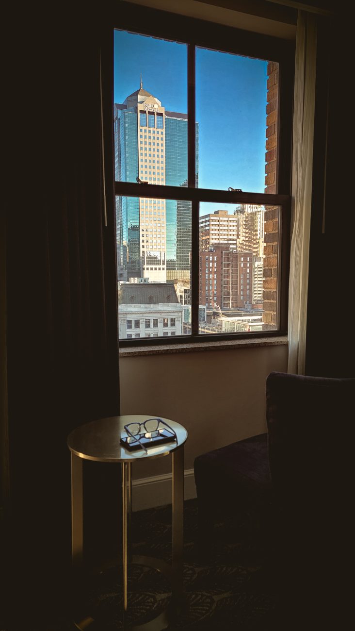
Empty Chair. Copyright © 2026 Gary Allman, all rights reserved. I’d planned to take a picture of Ginger sitting, enjoying the view, which would have been a great silhouette. But Ginger got up as I grabbed my phone. So instead, we have an empty chair. Hilton President Hotel, Kansas City, Missouri.
-
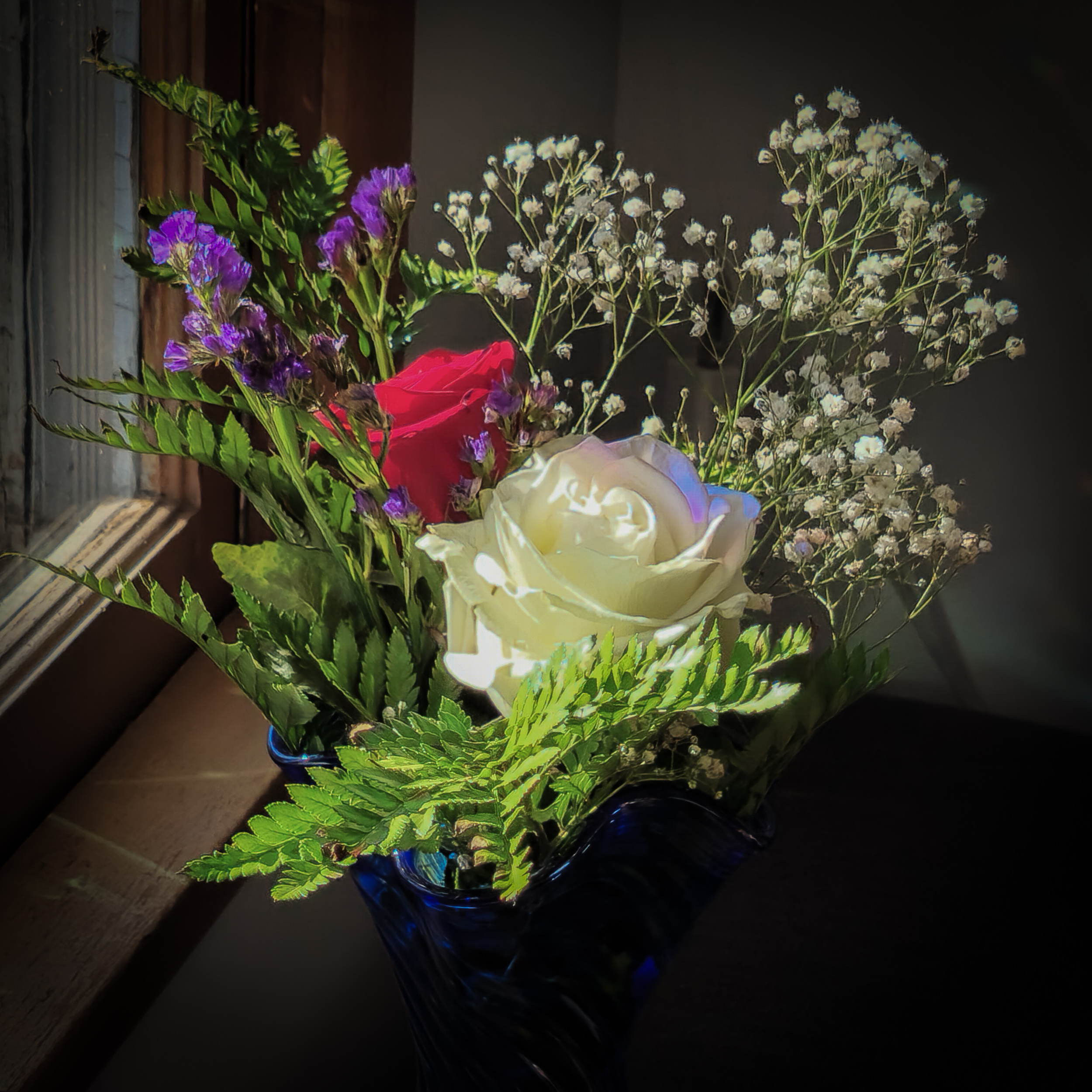
Ginger’s Flowers

Ginger’s Flowers. Copyright © 2026 Gary Allman, all rights reserved. Ginger loves to sit here in the sun in the winter. I liked the light on flowers and thought I’d try to capture it. Unfortunately, the battery was dead on my camera, so, I used my cell phone instead. The odd colored highlights are caused by the crystals we hang in the Sparkle Zone’s windows.

Ginger’s Flowers. Copyright © 2026 Gary Allman, all rights reserved. -
The Garden of the Gods, Colorado Springs
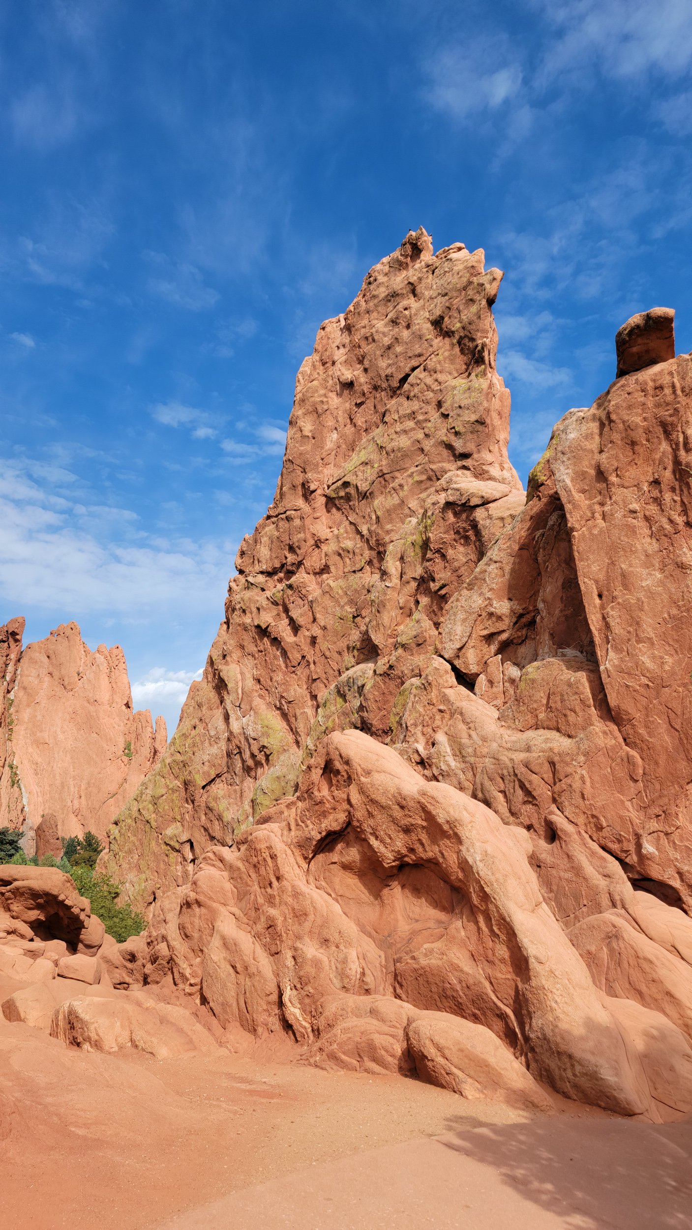
The Garden of the Gods, Colorado Springs. Day 9 – Road Trip October 2025. Copyright © 2025 Gary Allman, all rights reserved. I arrived in Colorado Springs on time, and we packed Ginger’s stuff into the car. Now what? We’d booked a hotel in Colorado Springs so that Ginger could take a rest, and I could get cleaned up ready for the next part of our trip, a visit to Ginger’s childhood town and haunts. Our hotel room wasn’t ready, so we went for a drive around, and quick a walk around some of the more popular parts of the Garden of the Gods. For a Friday afternoon in October the place was packed, so I gave up trying to get pictures there were just too many people getting in the way. This picture originally had four people in it.
-
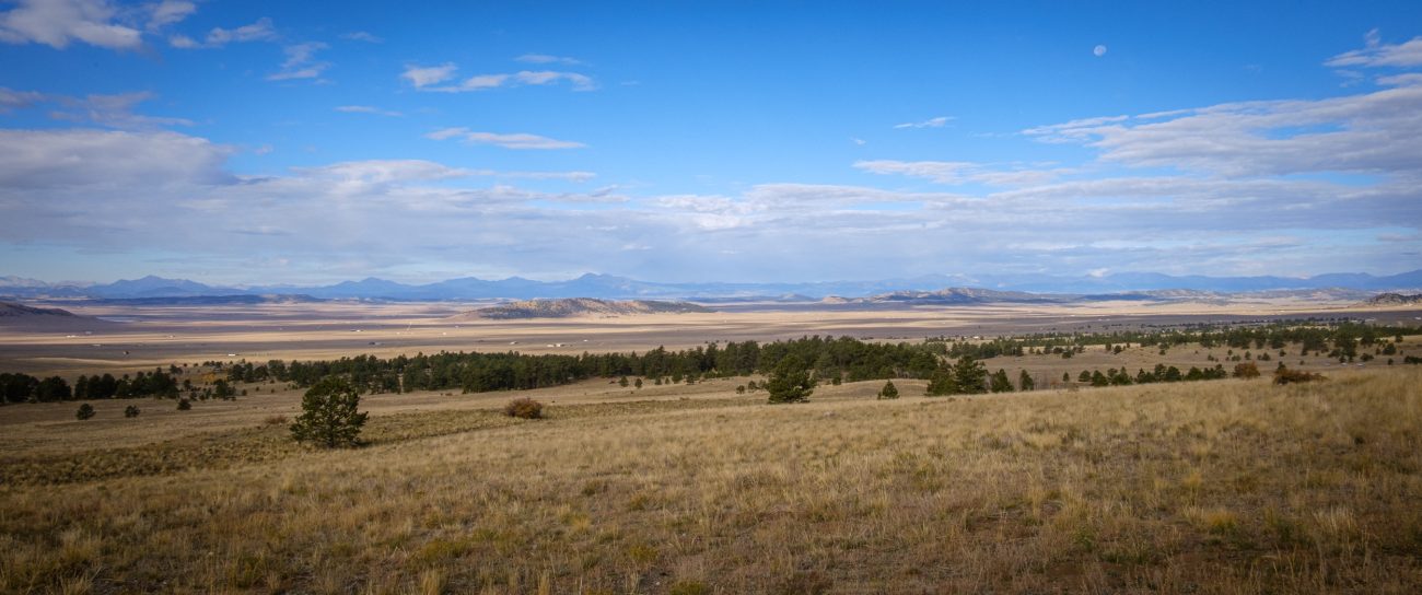
The sudden shock of being confronted with the expanse of the plains
The sudden shock of being confronted with the expanse of the plains. Day 9 – Road Trip, October 2025. Copyright © 2025 Gary Allman, all rights reserved. I saw this picture — well, one like it — while driving north on Day 3 and made a note to take a picture on the return trip, except I couldn’t find the exact viewpoint I’d found, which is a shame because it was a much better composition. Oh well, this photograph will have to do.
-
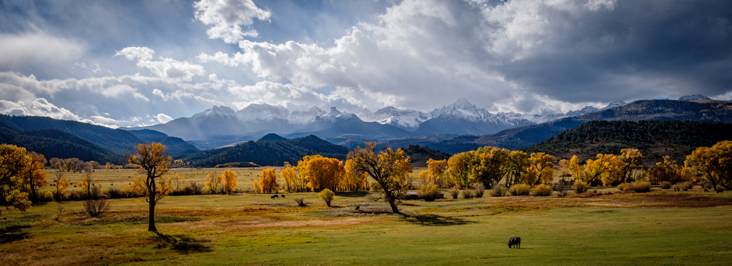
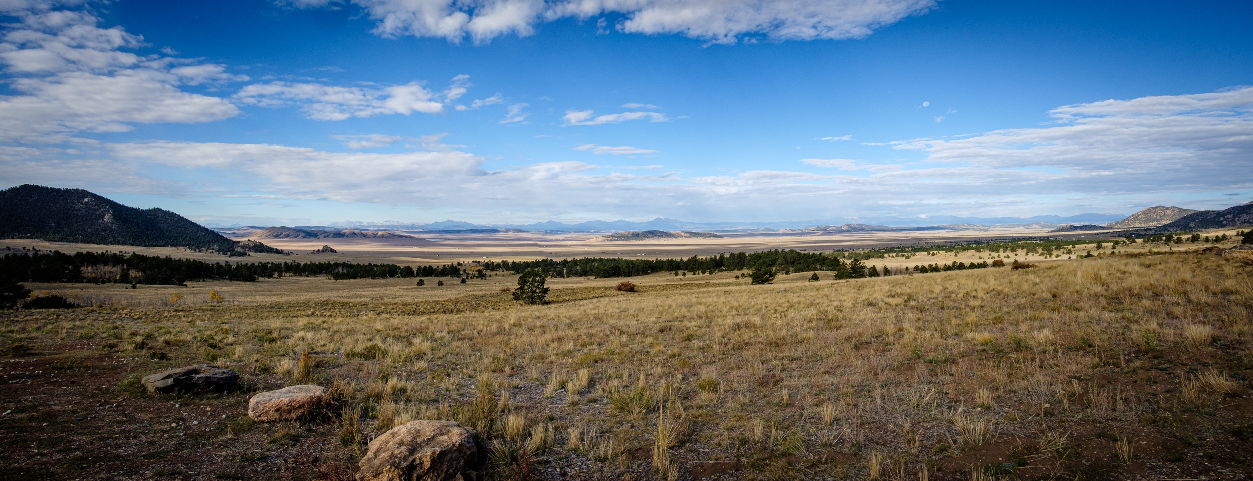
Plains and mountains
Plains and mountains — Seen from Hwy 24, Colorado. The Rocky Mountains are striking, but the unexpected plains between them took my breath away. Driving across the plains for miles and miles was humbling. Day 9 – Road Trip, October 2025. Copyright © 2025 Gary Allman, all rights reserved. -
Leaving Chalk Creek Canyon
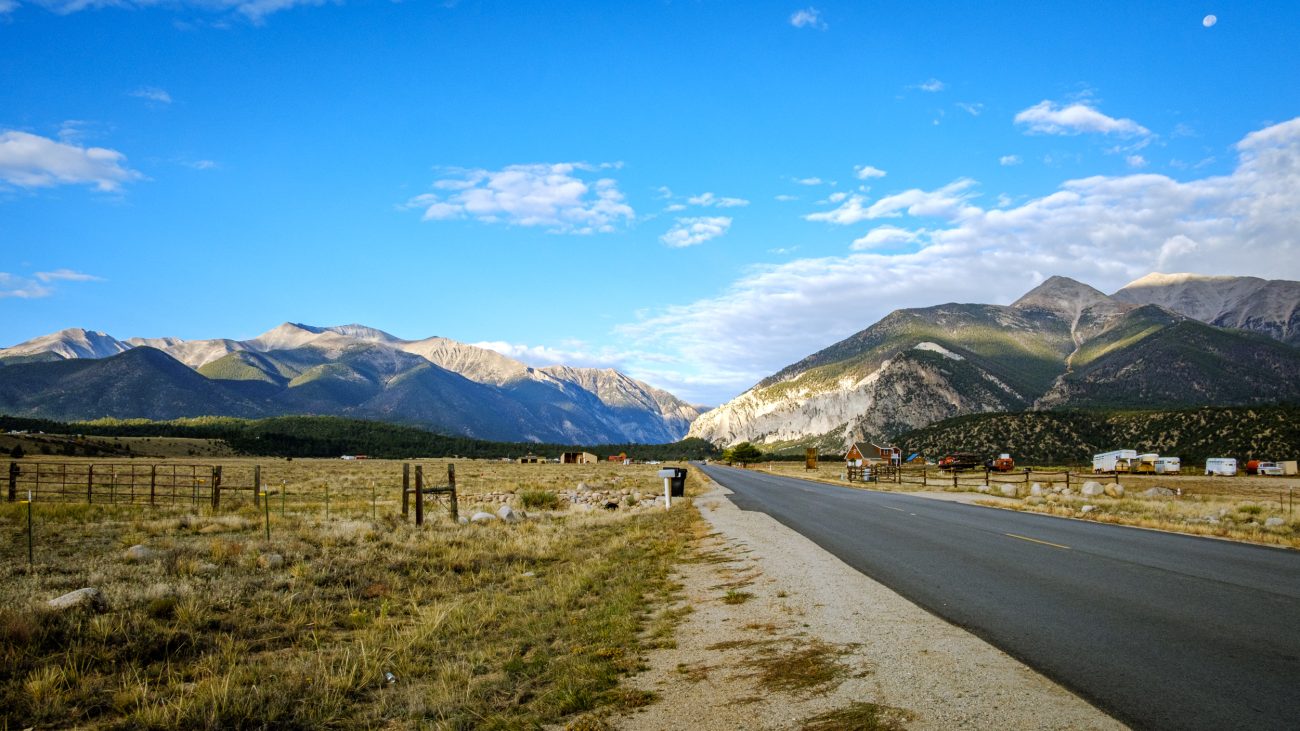
Leaving Chalk Creek Canyon — I hadn’t gone far before the scenery in the rearview mirror begged me to stop and take a picture. Day 9 – Road Trip, October 2025. Copyright © 2025 Gary Allman, all rights reserved. -
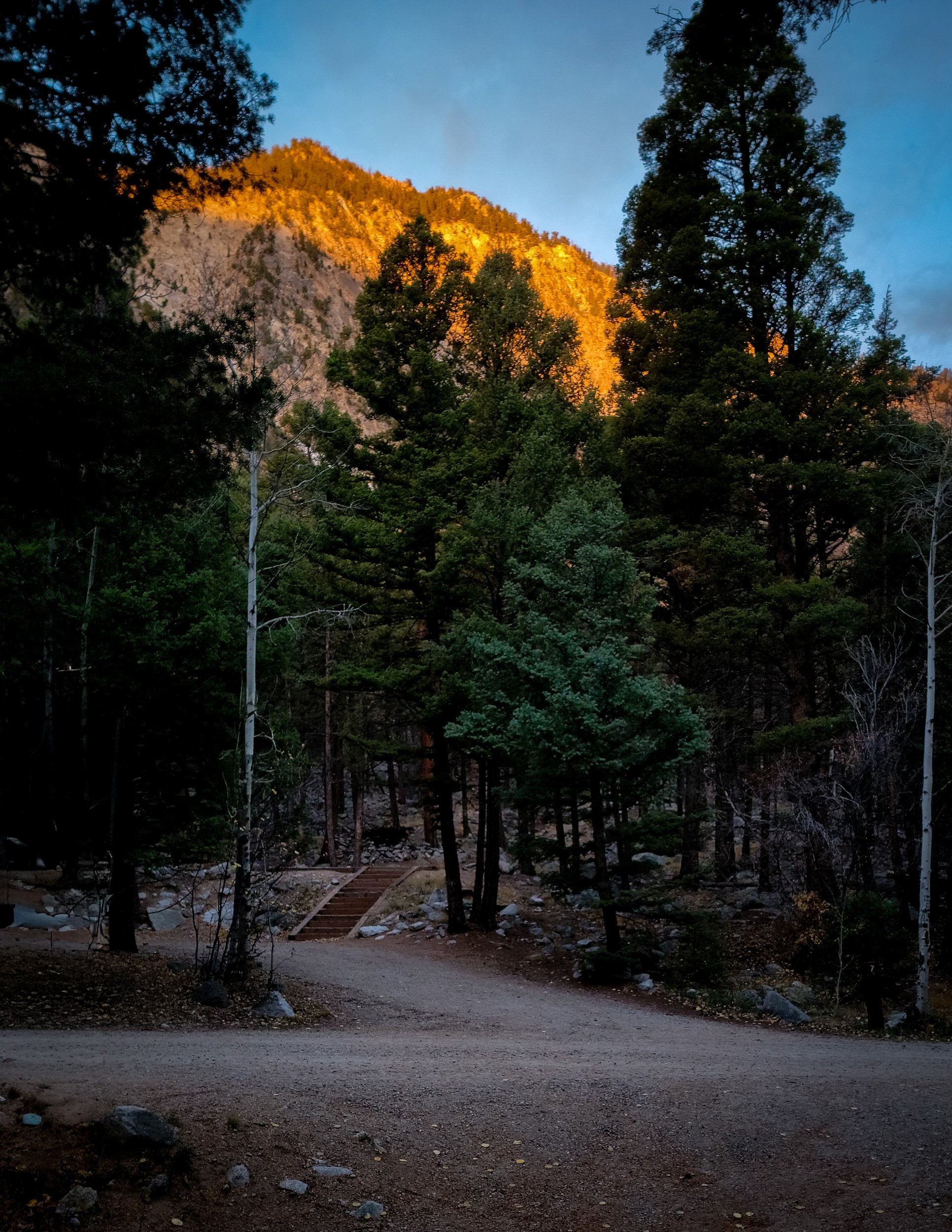
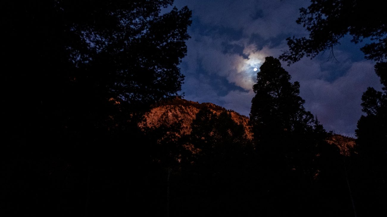
Sunshine on the cliff tops

Sunshine on the cliff tops — Just after seven the sunlight caught the tops of the cliff behind the campground. Time for a quick picture, finish packing everything away in the car, and get on my way. Day 9 – Road Trip, October 2025. Copyright © 2025 Gary Allman, all rights reserved. -
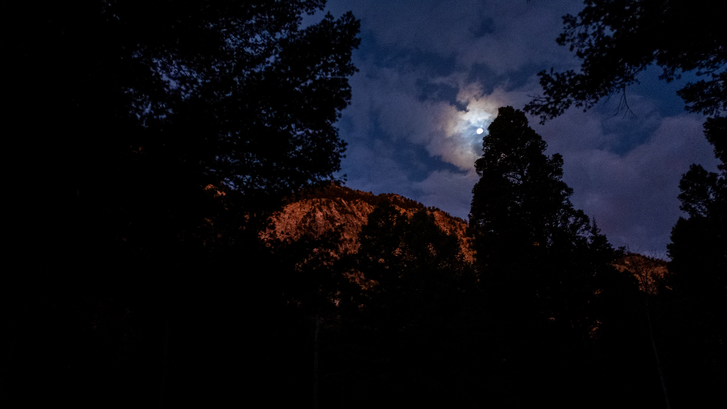
Day 9. Pre-dawn light
Up before dawn. Day 9 – Road Trip, October 2025. Copyright © 2025 Gary Allman, all rights reserved. It’s six-thirty, and I have to be in Colorado Springs shortly after ten. I allowed plenty of time to wake up and get ready to go. I packed away most of my stuff before bed, and set my alarm, and this was the view that greeted me when I got out of the tent.
-
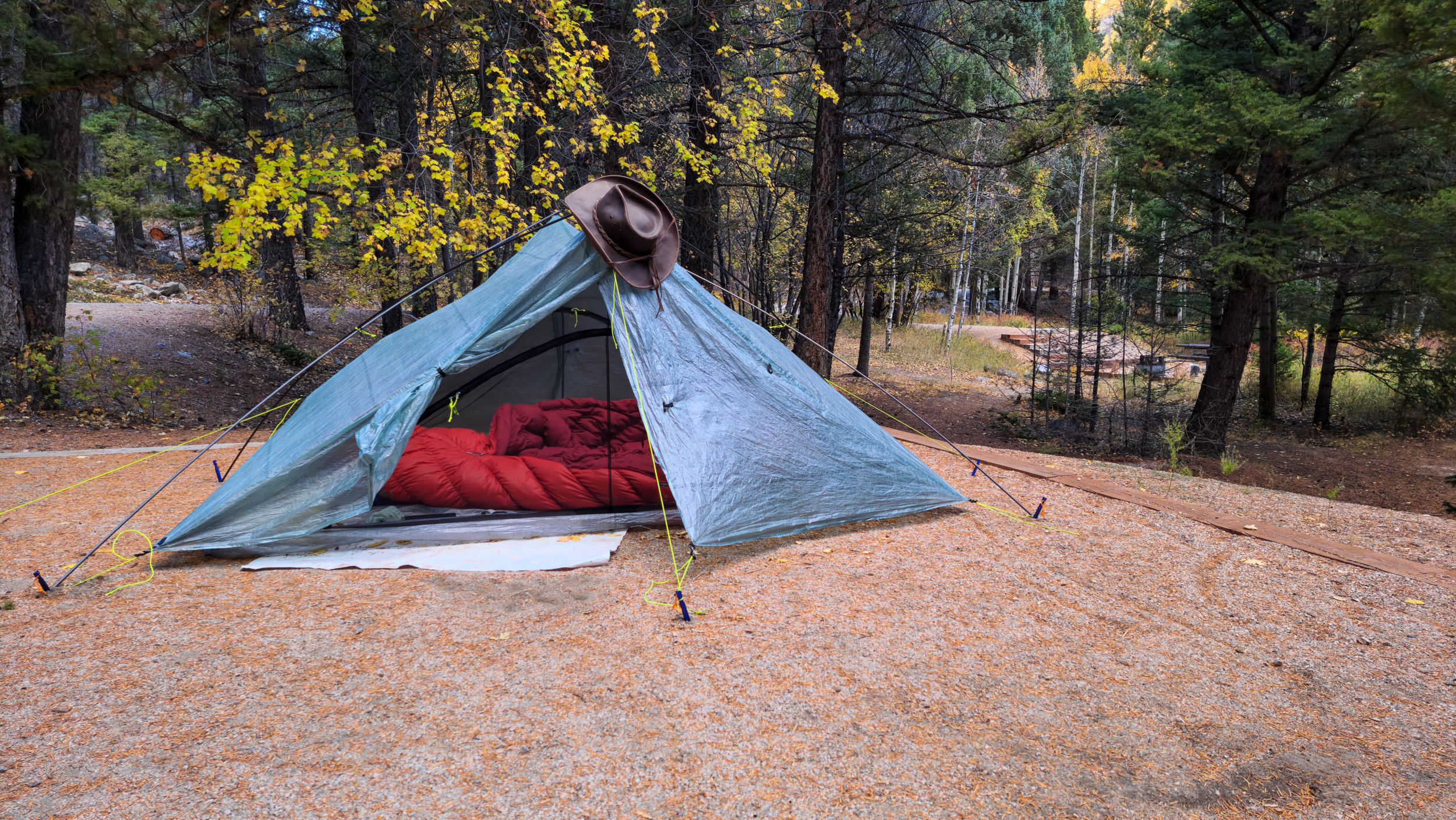
Well staked out

Well staked out. Day 8 – Road Trip October, 2025. Copyright © 2025 Gary Allman, all rights reserved. It’s been very windy, so I used all the tie out points on Ginger’s Zpacks Duplex tent. I also used the freestanding kit so I didn’t have to collapse the tent to use my hiking poles for hiking. Though, had I thought of it, I think Ginger has some carbon fiber tent poles I could have brought along.
I do like this tent, though I’ve never used it for backpacking. It would certainly be lighter than my hammock set up. But sleeping on the ground, even with Ginger’s four-inch thick sleeping pad, is not as comfortable as sleeping in my hammock. As to having to get down on my hands and knees to get in and out… I think it’s the hammock life for me.
-
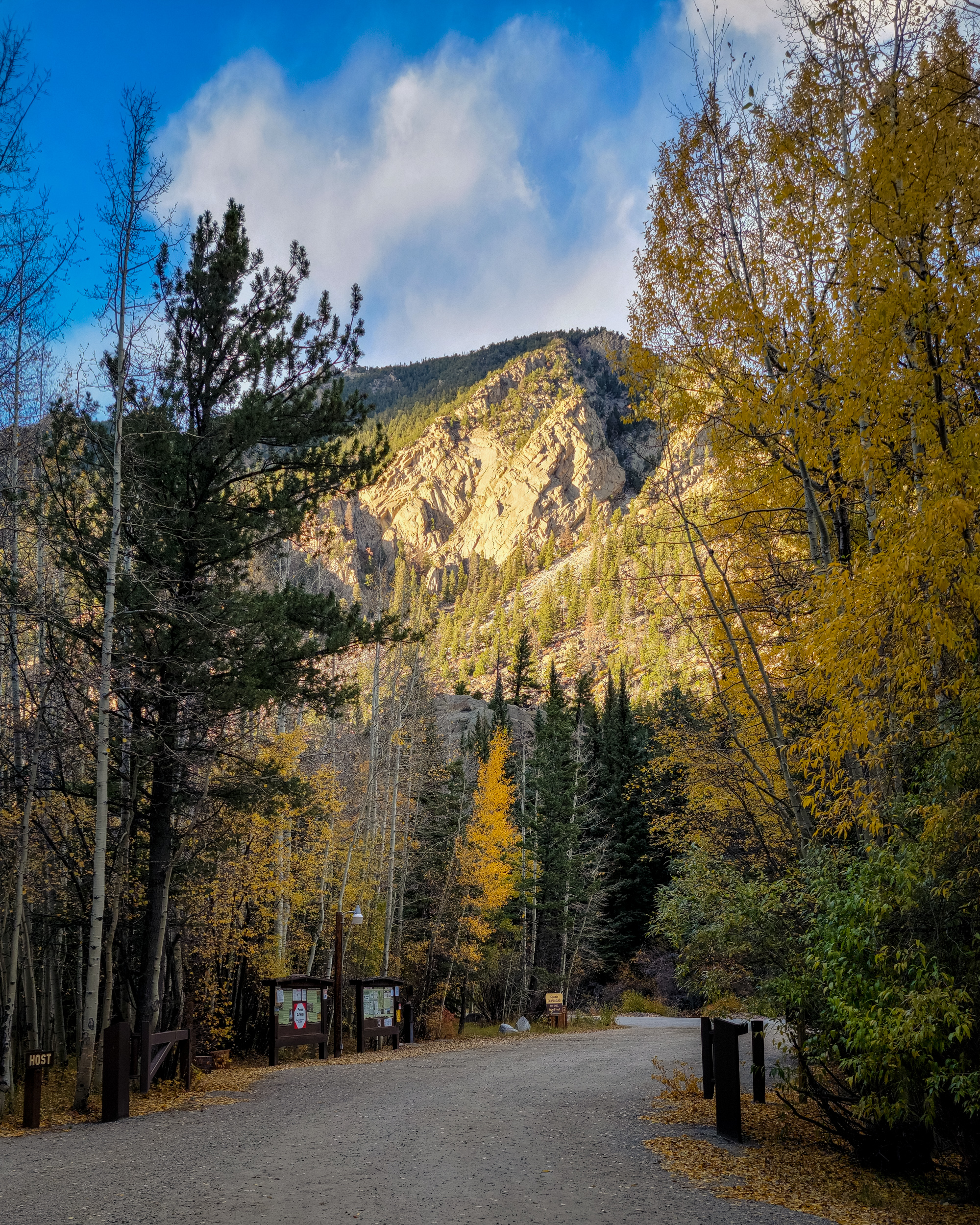
Entrance to the Cascade Campground

Entrance to the Cascade Campground — Looking out towards the road. Day 8 – Road Trip, October 2025. Copyright © 2025 Gary Allman, all rights reserved.