Welcome to Breakfast in America
I’m a Brit who unexpectedly emigrated to the USA in 2008, and this is my photo journal.
It’s an eclectic mix of things; there’s no guiding theme or topic. It is whatever catches my attention, what I’ve been thinking, doing, or piques my interest. Currently that’s mainly backpacking and clearing some of the backlog on my ‘honey-do’ list.
Popular posts
Trending pictures and short posts.


Memories
A dozen pictures, picked at random from my favorite memories. You can see my portfolio here.

Thanksgiving 2016 – Family Picture

Fallingwater — Frank Lloyd Wright

More fun in the workshop (365:095)

Contrasting Spaces #1

Whites Creek on the Whites Creek Trail South Loop

Camped in ‘Twin Falls Hollow’

Distant Hills

On The Devil’s Den East (Upper Pilot) Trail

Jim Beam and 400 West Market

Annular Eclipse Timelapse

Pool on Whites Creek, Irish Wilderness

Journaling
Recent Posts
-
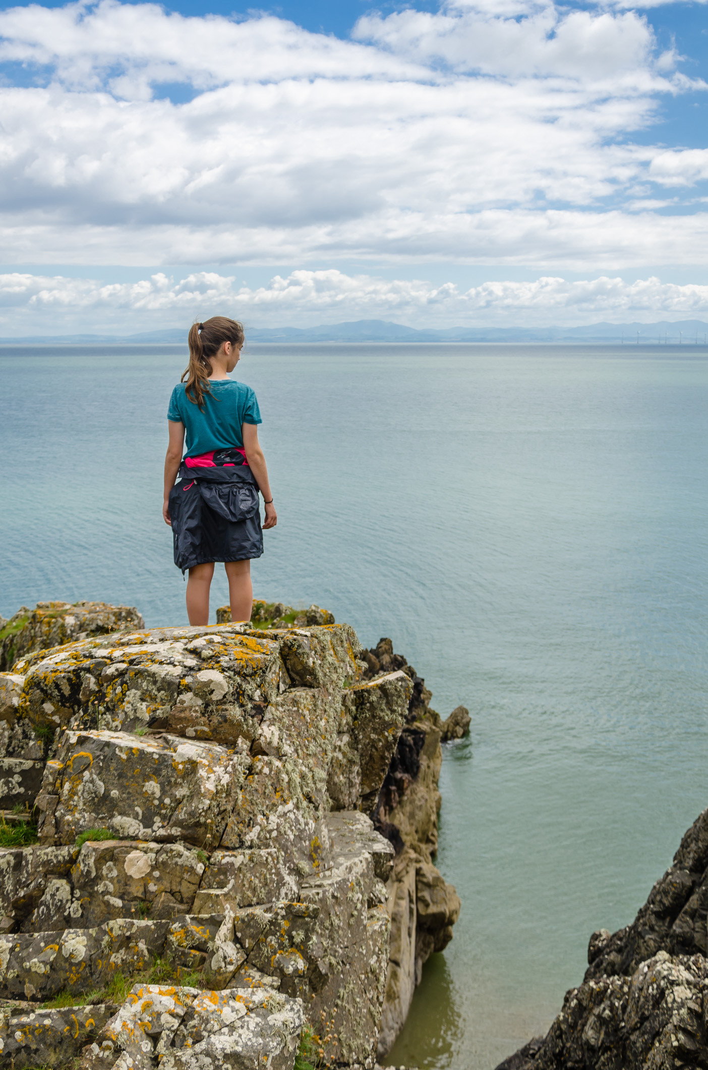
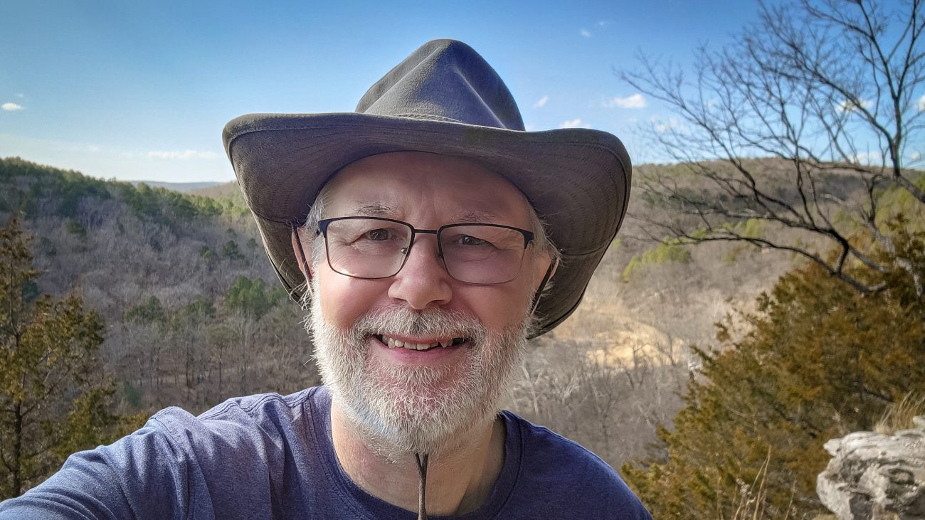
Gary at the Big Paddy Creek Scenic Overlook, Paddy Creek Wilderness

Gary at the Big Paddy Creek Scenic Overlook, Paddy Creek Wilderness — It was very windy up on the ridge, and the wind was quite chilly, which was nice as it was 82°F in the sun. This is another Ozarks view I never tire of. Backpacking the Big Piney Trail, February 2026. Copyright © 2026 Gary Allman, all rights reserved. It was very windy up on the ridge, and the wind was quite chilly, which was nice as it was 82°F in the sun.
This is another Ozarks view I never tire of.
There’s cell service here, and I checked the forecast for tonight and tomorrow. Lows of 24°F overnight, then 34°F and windy tomorrow. That’s not what I planned for when I packed my 40°F top quilt. But I have a plan, and all should be good. I just need to get to ‘Paddy Creek Trolltunga‘, and that’s a few miles and several hundred feet of elevation gain away.
-
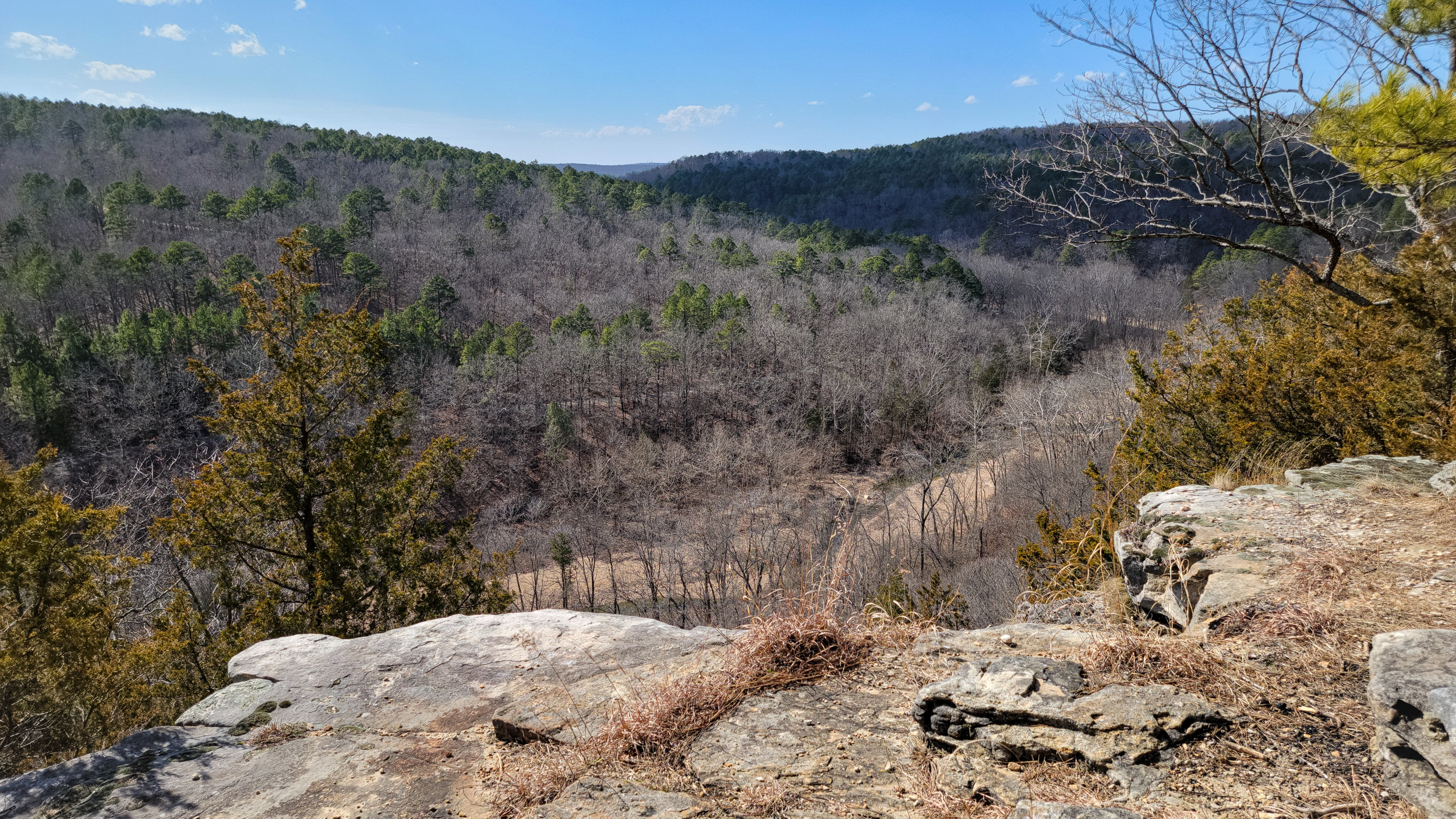
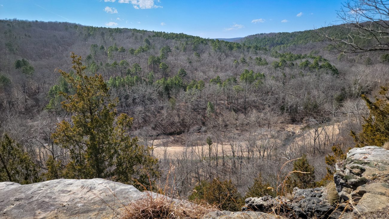
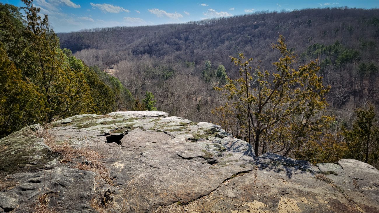
Big Paddy Creek Scenic Overlook, Paddy Creek Wilderness

Big Paddy Creek Scenic Overlook, Paddy Creek Wilderness — I’ve taken pictures of this view before, but what the heck, here’s another. Backpacking the Big Piney Trail, February 2026. Copyright © 2026 Gary Allman, all rights reserved. I’ve taken pictures of this view before, but what the heck, here’s another. The road in the middle distance goes to the campground, the road running up to the top of the ridge is Paddy Creek Road. The trail crosses almost straight ahead in this image. I just have to get over there.
Big Paddy Creek Scenic Overlook, Paddy Creek Wilderness — Backpacking the Big Piney Trail, February 2026. Copyright © 2026 Gary Allman, all rights reserved. -
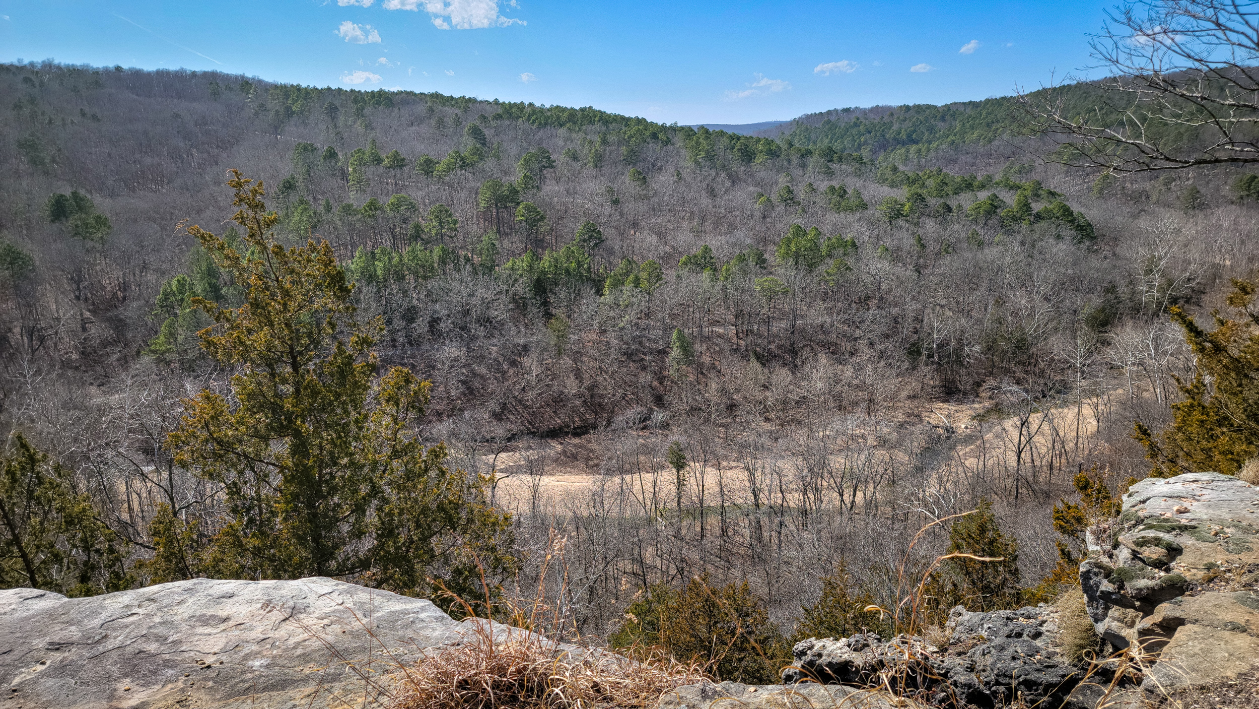
Big Paddy Creek Scenic Overlook, Paddy Creek Wilderness
Big Paddy Creek Scenic Overlook, Paddy Creek Wilderness — This is looking to the southeast. The campground is somewhere near the light patch in the distance. Backpacking the Big Piney Trail, February 2026. Copyright © 2026 Gary Allman, all rights reserved. -
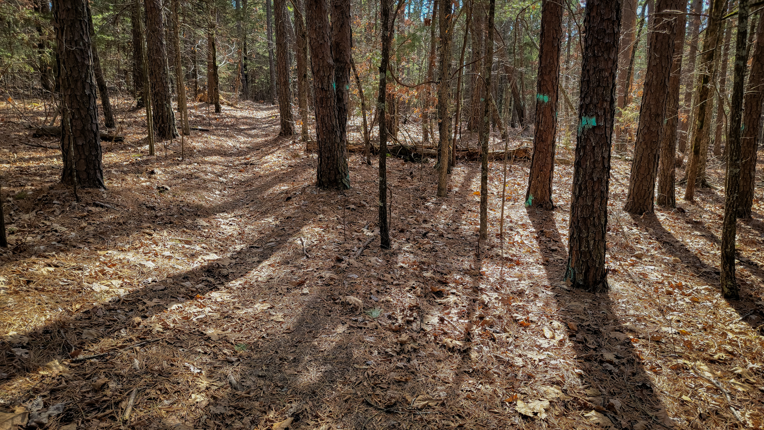
Blazes? We don’t need no stinking blazes
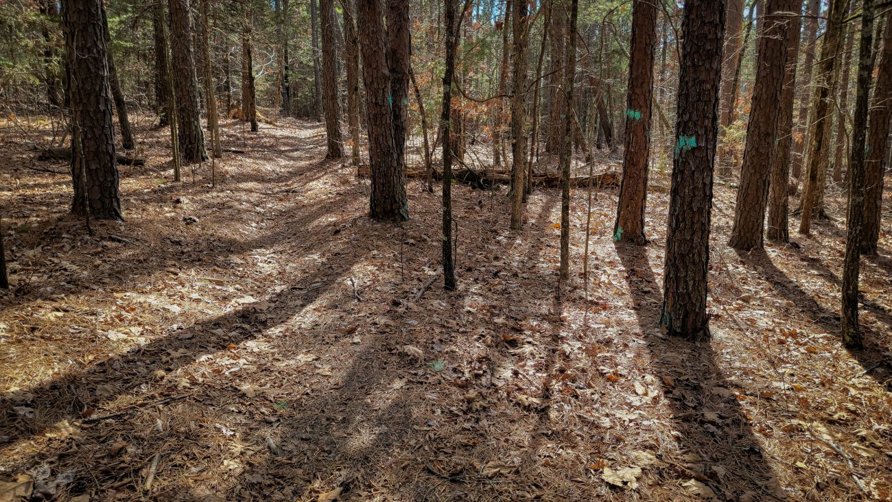
Blazes? We don’t need no stinking blazes — Backpacking the Big Piney Trail, February 2026. Copyright © 2026 Gary Allman, all rights reserved. Yes I’ve used that image title before. Then it was on the Berryman Trail. I hope they are more restrained here. At Berryman the trees were thinned out to the point where there’s very little shade left for hikers, and it looked pretty bare.
-
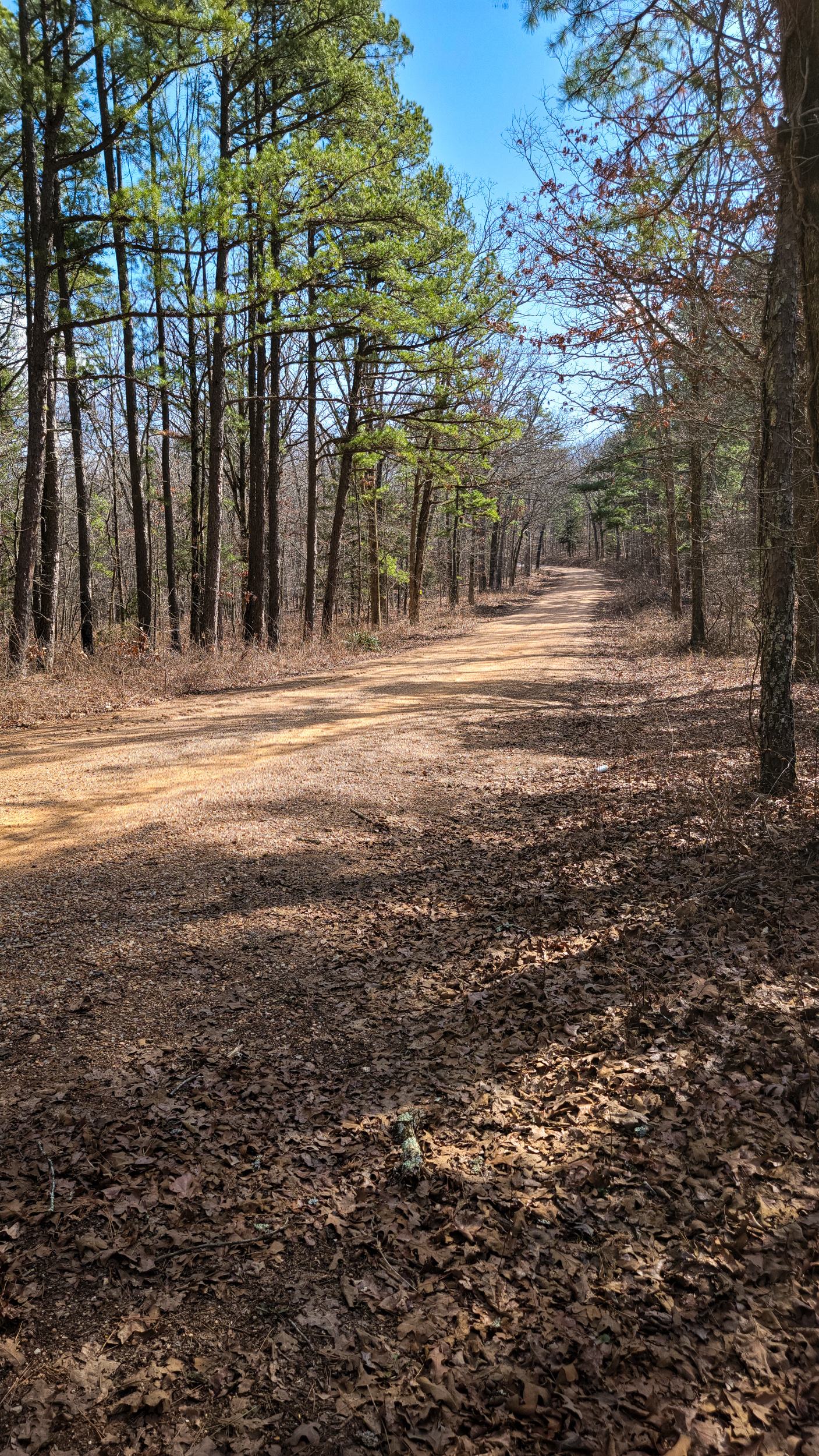
Paddy Creek Road Looking southeast, Big Piney Trail, Paddy Creek Wilderness — Day Two

Paddy Creek Road Looking southeast, Big Piney Trail, Paddy Creek Wilderness — Day Two. Backpacking the Big Piney Trail, February 2026. Copyright © 2026 Gary Allman, all rights reserved. This is the first Paddy Creek Road crossing if you are hiking the trail clockwise. To the south of the road is Paddy Creek Wilderness, to the north, Mark Twain National Forest. We’re about to cross over into Mark Twain National Forest.
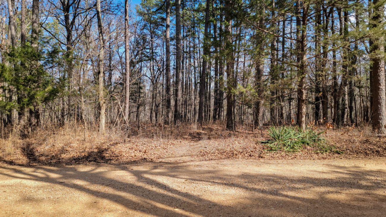
View across Paddy Creek Road to the northeast, Big Piney Trail, Paddy Creek Wilderness — Backpacking the Big Piney Trail, February 2026. Copyright © 2026 Gary Allman, all rights reserved. Where the trail continues is easy to see across the road. Not so much the second crossing of Paddy Creek Road, above the Paddy Creek Campground. There you have to go up hill a few yards to find where the trail picks up.
-
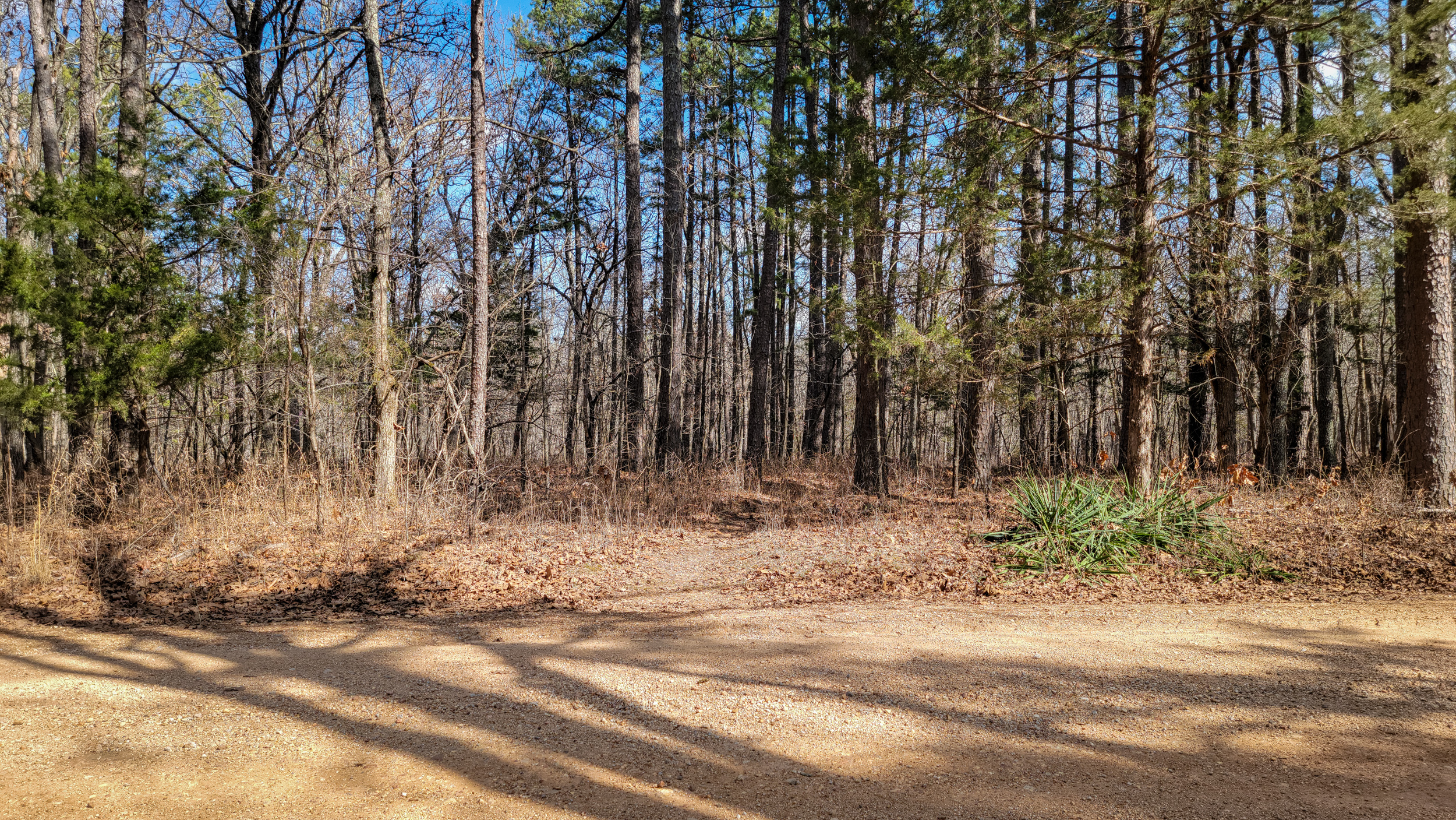
South Loop/North Loop Short Cut on the Big Piney Trail
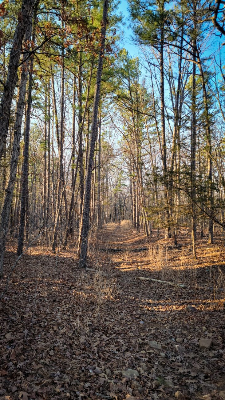
South Loop/North Loop Short Cut, Big Piney Trail, Paddy Creek Wilderness. Backpacking the Big Piney Trail, February 2026. Copyright © 2026 Gary Allman, all rights reserved. South Loop/North Loop Short Cut, Big Piney Trail — just a short way further along the trail it drops down towards Little Paddy Creek. In that section I encountered some very thick wood smoke. Even though I know from experience that smoke can travel miles and still be very thick, it was a bit disconcerting!
This is my last picture of the day, and I didn’t take any pictures of my camp in ‘Spring Hollow’ either. The light was fading as I got to the point where I leave the trail, and rather than scrambling over huge boulders and down very steep hillsides in the diminishing light, I tried another route cutting into the hollow from the south after I had passed the shut-ins and spring. That worked, and I arrived just as it started to get dark. I was very pleased to see water running in the creek. The spring must still be running, despite the drought.
-
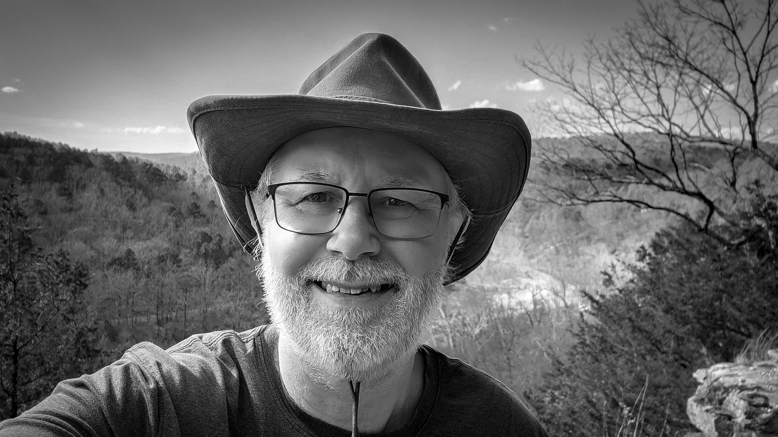
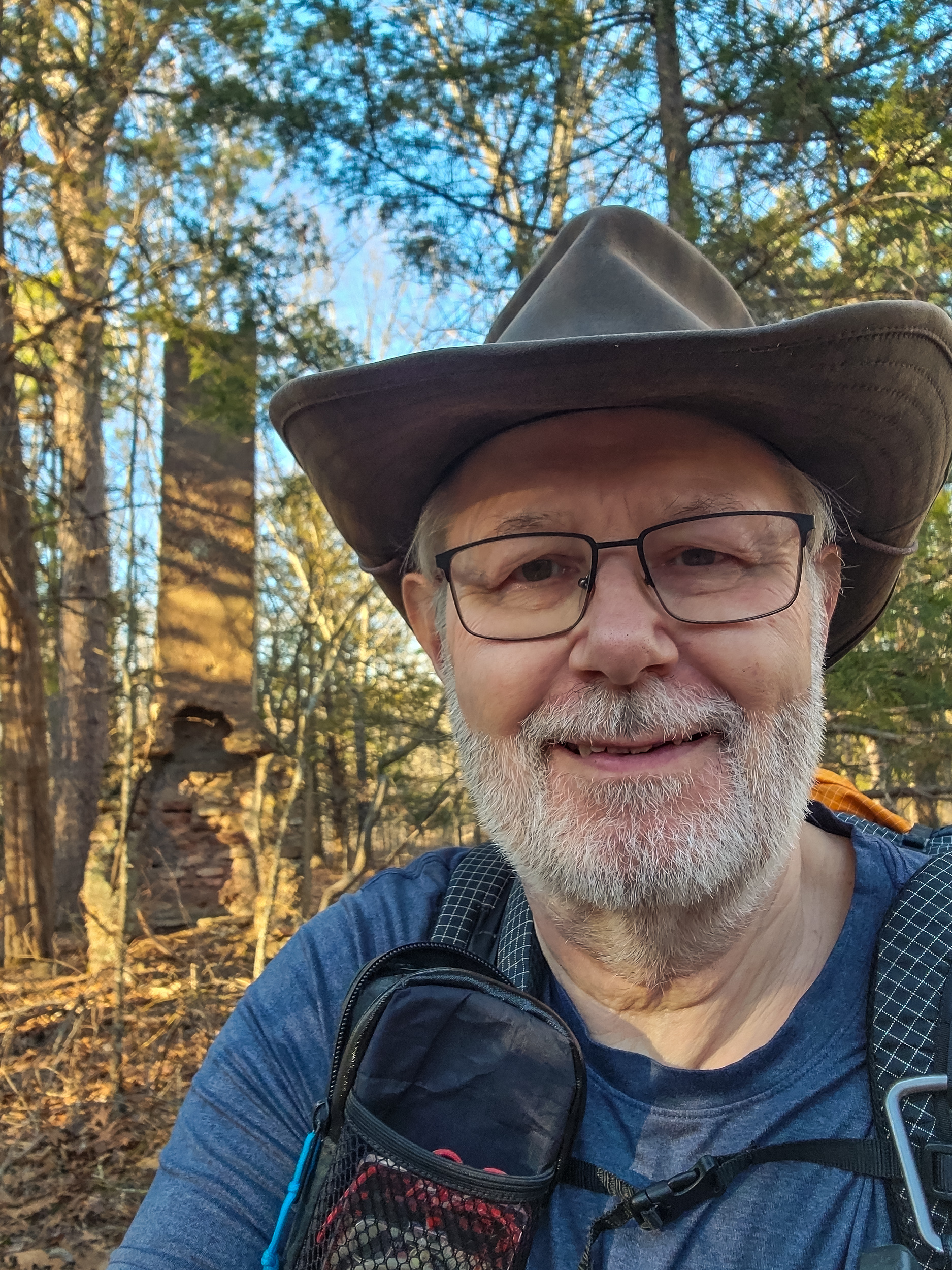
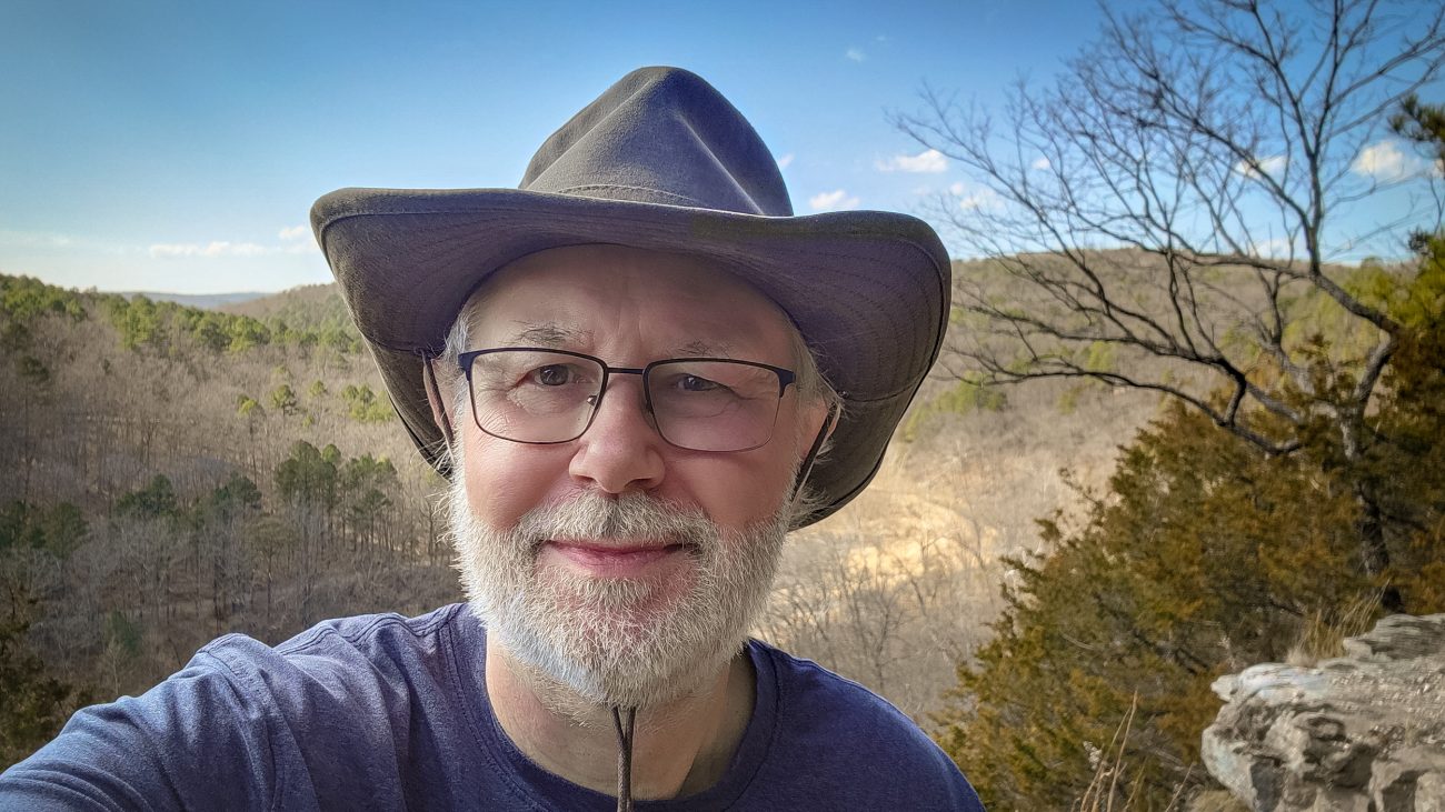
Gary on the Big Piney Trail, Paddy Creek Wilderness, February 2026

Gary on the Big Piney Trail, Paddy Creek Wilderness, February 2026 — Time for another quick selfie. It’s after four pm, and I have a couple of miles left to go. Backpacking the Big Piney Trail, February 2026. Copyright © 2026 Gary Allman, all rights reserved. -
All that remains
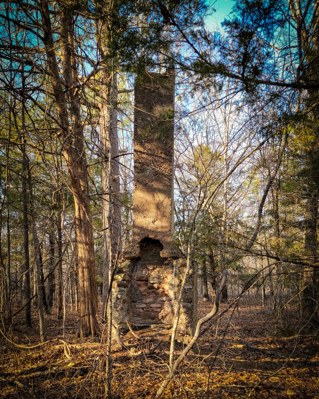
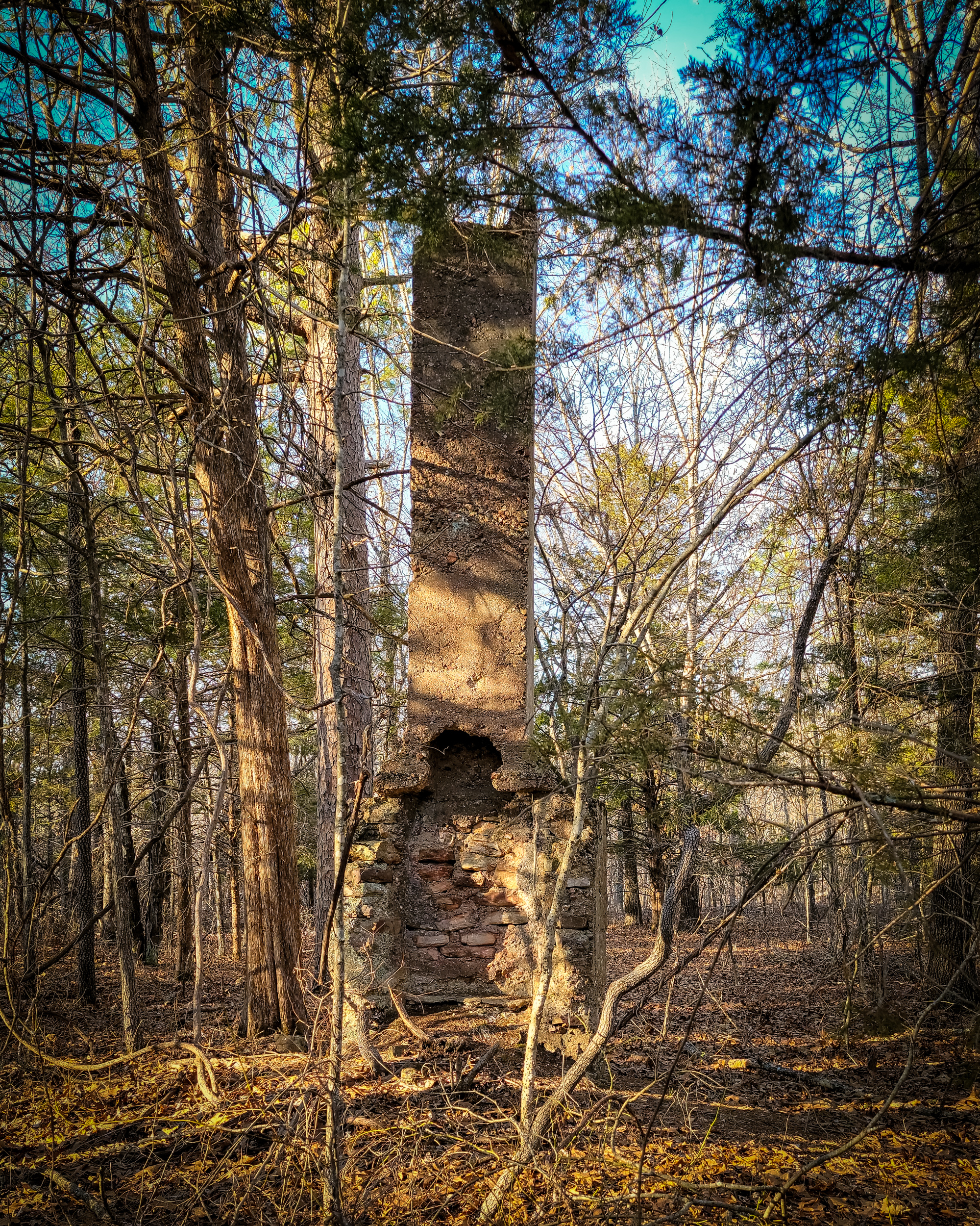
All that remains — Backpacking the Big Piney Trail, February 2026. Copyright © 2026 Gary Allman, all rights reserved. The homestead chimney at the junction of the South Loop and the shortcut to the North Loop, Paddy Creek Wilderness. There’s a well and circular foundation nearby too.
I’ve often wondered what it was like to live here, presumably after the area had been clear cut. There is evidence of several major old ‘roads’ to be seen in the wilderness near here.
From here I’m taking the Short Cut to the North Loop. And my hunch about the burn ban was right. There’s cell phone reception here and I received the ‘Red Flag’ notification while checking in with Ginger. It’s 16:10, and I have a couple of miles left to go.
-
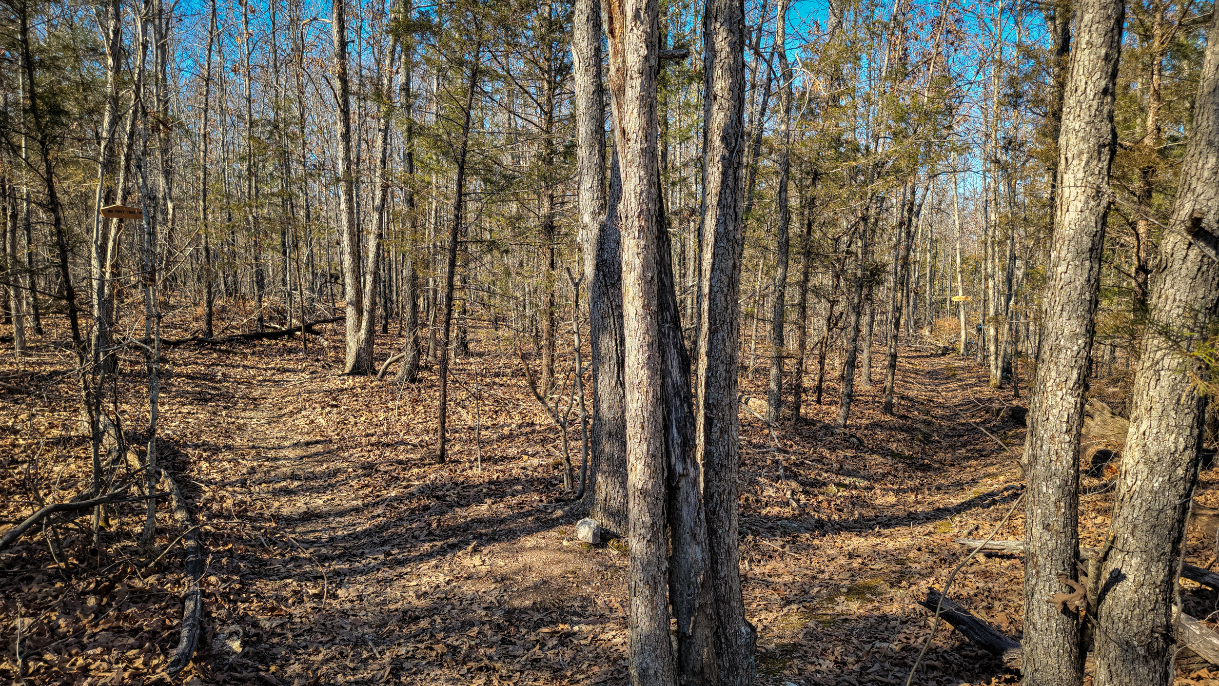
Big Piney Trail
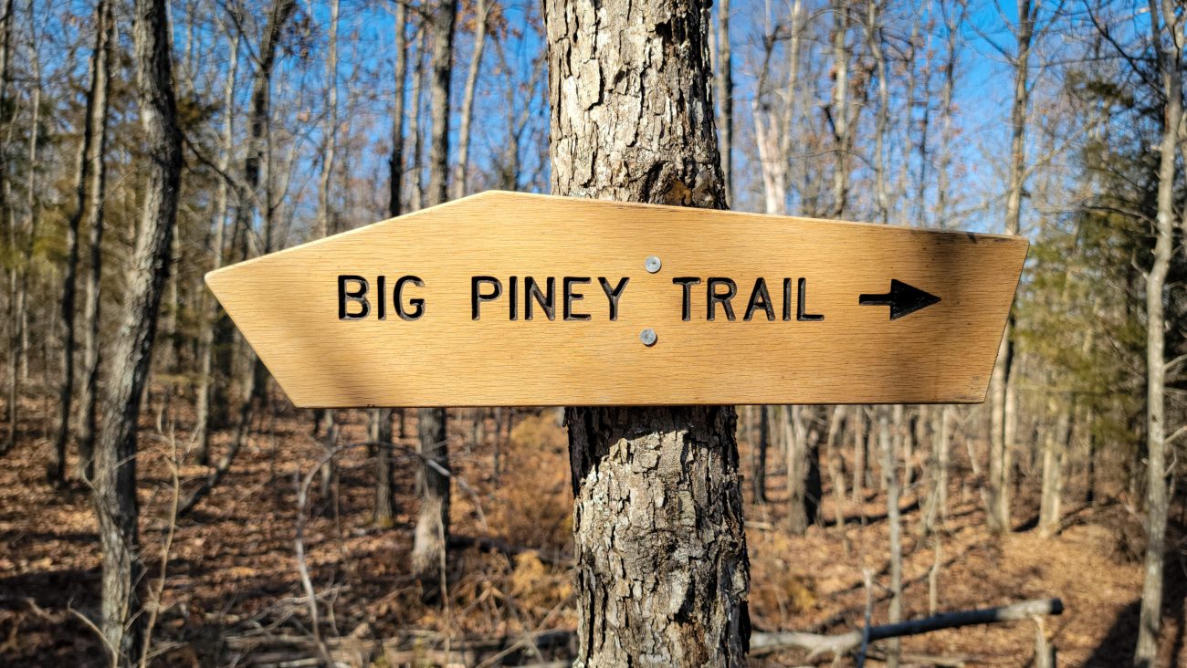
Big Piney Trail — these signs are easy to spot when they are new, but after a year or so they go gray and almost invisible unless you know to look out for them. Backpacking the Big Piney Trail, February 2026. Copyright © 2026 Gary Allman, all rights reserved. -
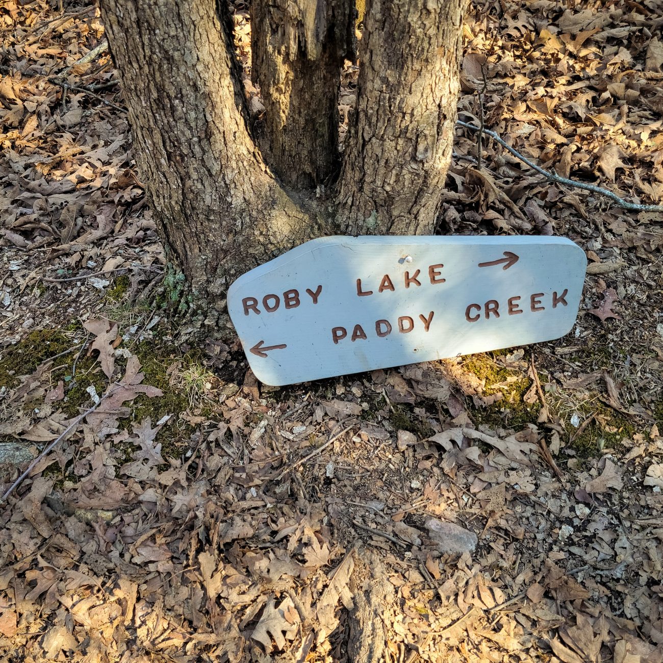
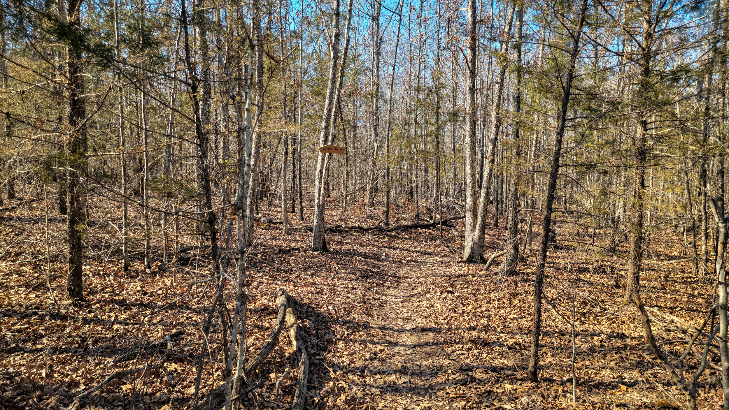
New Trail junction on the Big Piney Trail

New Trail junction on the Big Piney Trail — Backpacking the Big Piney Trail, February 2026. Copyright © 2026 Gary Allman, all rights reserved. Back in December 2024, I met a Forest Ranger and a couple of guys near the Roby Lake trailhead. They’d been surveying the North Loop between the trail junction and the falls assessing changes to the trail, as it had become eroded and rough in places. That work looks to have been completed, and the start of the South loop has been rerouted too. According to my GPS, this junction is located a tenth of a mile from the old trail junction. For the North Loop, take a left, for the South Loop, go straight on.
My only concern about this change is that the most popular route for ‘Sunday afternoon hikers,’ the North Loop to the Falls and back, is not clearly identified. There is no mention of North/South Loops or the falls on the signs to help people who don’t have maps or know the area. Wildernesses are not supposed to have blazes and signs, but more blazes and signs seem to be appearing all the time.
According to another Ranger I met a few years ago, this has been driven by a need to cut rescue efforts and cost. Cell phones have emboldened people to venture out without the necessary preparations and gear, which means they get lost, or into difficulties. To my mind leaving the trail names off these signs defeats the reason for having them in the first place.